- Find My WaterWay
- Estuaries
-
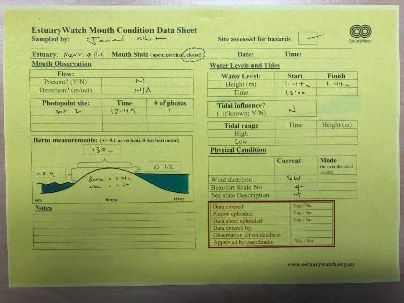
Merri River Estuary
- Observations
- 05-10-2022
Back to list of observations
Observation details
Notes
Beach berm measured by Jarred Obst using RTK GPS unit as part of ARMO consideration monitoring.
Mouth Observation
|
Mouth state
|
Closed |
|
Previous
|
C
C
C
C
C
O
C
C
C
C
C
C
C
C
C
O
C
C
C
C
C
C
C
C
C
C
C
|
| Flow Present? |
No |
|
Previous
|
N
N
N
N
N
Y
N
N
N
N
N
N
N
N
N
Y
N
N
N
N
N
N
N
N
N
N
N
|
| Flow Direction |
N/A |
|
Previous
|
N
N
N
N
N
O
N
N
N
N
N
N
N
N
N
O
N
N
N
N
N
N
N
N
N
N
N
|
|
Above Sea |
Above Estuary |
| Berm Height (m) |
0.9m |
0.6m |
|
Berm Length (m)
|
130.0m |
Physical Condition
Observation Documents
| Link |
Date |
File name |
Description |

|
13-10-2022 12:55 |
EW_Mouth_Condition_RC_20221005.jpg |
|

|
13-10-2022 12:55 |
MP2_20221005.jpg |
|

 All content, files, data and images provided by the EstuaryWatch Data Portal subject to a Creative Commons Attribution License
Data portal by CeRDI
All content, files, data and images provided by the EstuaryWatch Data Portal subject to a Creative Commons Attribution License
Data portal by CeRDI