BaMC Barham River Mouth Condition
19 February 2026
Observation details
Overview
| Estuary | Barham River Estuary |
|---|---|
| Site | Barham River Mouth Condition |
| Observation ID | #17446 |
| Date and Time | Thursday 19th February 2026 12:25pm |
| Approved | Approved |
Notes
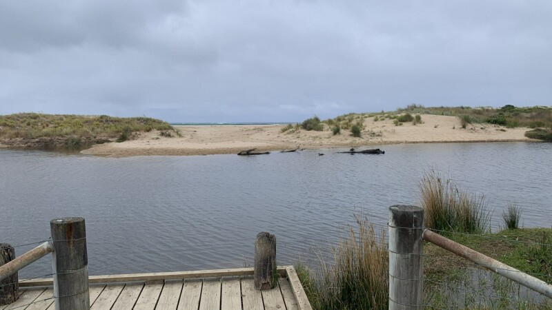
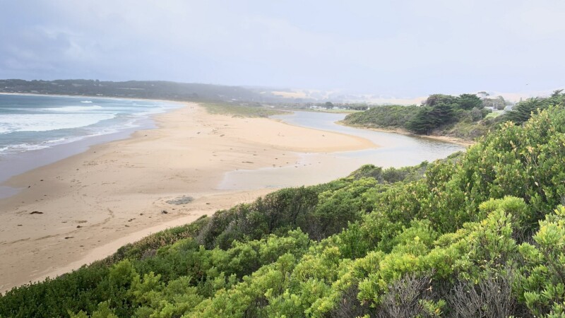
Water level below bottom of guage.
Berm - wet sand across whole of berm, may well be open again at next high tide. I didnt measure width, but at lowest point, this was not very wide. I was on my own today so measurements a bit difficult - reasonable estimates I think!
Note - there has been heavy traffic along this stretch of beach for last 10 days for sand renourishment at Marengo Beach. I don't know if this will affect conditions.
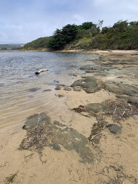
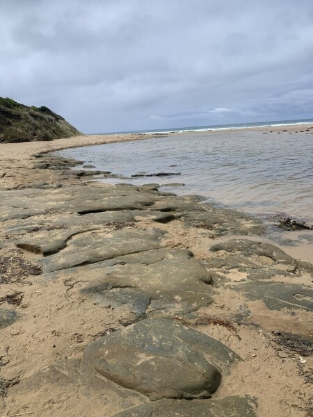
Note 2 - photos of rocks along golf course side of river mouth for Rachel who was interested to see their exposure in different conditions.
Mouth Observation
| Mouth state | Closed |
|---|---|
| Previous | O O O O O O O C O O O O O O O O O O P C C O O O O O O O |
| Flow Present? | Yes |
| Previous | Y Y Y Y Y Y Y N Y Y Y Y Y Y Y Y Y Y N N N Y Y Y Y Y Y Y |
| Flow Direction | Out |
| Previous | I I I I O O O N O O O O O O O O O I N N N O O I O O O O |
| Above Sea | Above Estuary | |
|---|---|---|
| Berm Height (m) | 0.5m | 0.3m |
| Berm Length (m) |
Physical Condition
| Current | Mode | |
|---|---|---|
| Wind Direction | West | |
| Beaufort Scale | Gentle breeze | |
| Sea State | Slight |
We acknowledge and respect Victorian Traditional Owners as the original custodians of Victoria’s land and waters, their unique ability to care for Country and deep spiritual connection to it.
We honour Elders past and present whose knowledge and wisdom has ensured the continuation of culture and traditional practices.
We honour Elders past and present whose knowledge and wisdom has ensured the continuation of culture and traditional practices.
 All content, files, data and images provided by the EstuaryWatch Data Portal subject to a Creative Commons Attribution License
Data portal by CeRDI
All content, files, data and images provided by the EstuaryWatch Data Portal subject to a Creative Commons Attribution License
Data portal by CeRDI