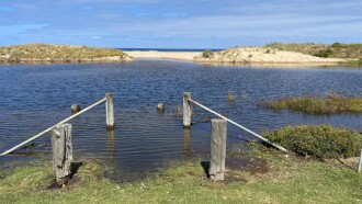
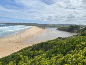
BmMC Barham River Observation Site
20 February 2025
Observation details
Overview
| Estuary | Barham River Estuary |
|---|---|
| Site | Barham River Observation Site |
| Observation ID | #16749 |
| Date and Time | Thursday 20th February 2025 15:10pm |
| Approved | Approved |
Mouth Observation
| Mouth state | Closed |
|---|---|
| Previous | O O O O O O O C O O O O O O O O O O P |
| Flow Present? | No |
| Previous | Y Y Y Y Y Y Y N Y Y Y Y Y Y Y Y Y Y N |
| Flow Direction | N/A |
| Previous | I I I I O O O N O O O O O O O O O I N |
| Above Sea | Above Estuary | |
|---|---|---|
| Berm Height (m) | 0.9m | 0.1m |
| Berm Length (m) | 20.7m |
Physical Condition
| Current | Mode | |
|---|---|---|
| Wind Direction | South-East | |
| Beaufort Scale | Gentle breeze | |
| Sea State | Slight |


 All content, files, data and images provided by the EstuaryWatch Data Portal subject to a