WyMC Wye River Mouth Condition
2 July 2023
Observation details
Overview
| Estuary | Wye River Estuary |
|---|---|
| Site | Wye River Mouth Condition |
| Observation ID | #15618 |
| Date and Time | Sunday 2nd July 2023 10:00am |
| Approved | Approved |
Notes
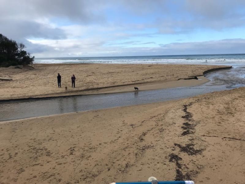
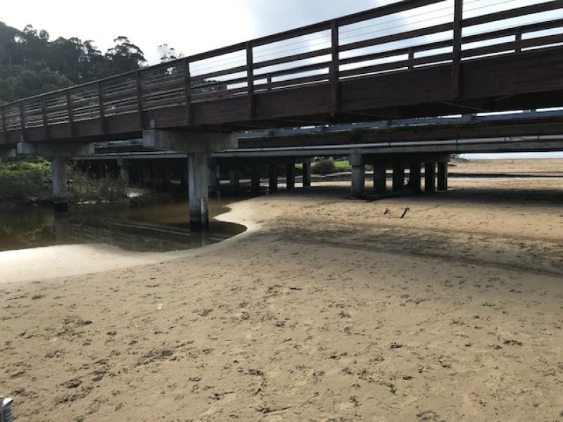
Lots of sand movement in the past few weeks. Sand deposited upstream of bridge, see photos attached. Also the river channel has been eroding the beach on the west side adjacent to the Great Ocean Road. In the past few weeks there have been some steep sand banks however these have eroded down. Estuary Watch coincided with high tide.
Mouth Observation
| Mouth state | Open |
|---|---|
| Previous | O O O O O O O O O O O O O O O O O O O O O O O O O O O O O O O O O O O O O O O O O O O O O O O O O O O O O O O O O O O O |
| Flow Present? | Yes |
| Previous | Y Y Y Y Y Y Y Y Y Y Y Y Y Y Y Y Y Y Y Y Y Y Y Y Y Y Y Y Y Y Y Y Y Y Y Y Y Y Y Y Y Y Y Y Y Y Y Y Y Y Y Y Y Y Y Y Y Y Y Y |
| Flow Direction | Out |
| Previous | O O O O O O O O O O O O O O O O O O I I O O O O O O O O O O O O O O O O O O O O O O O O O O O O O O O O O O O O O O O O |
| Above Sea | Above Estuary | |
|---|---|---|
| Berm Height (m) | ||
| Berm Length (m) |
Physical Condition
| Current | Mode | |
|---|---|---|
| Wind Direction | South-West | |
| Beaufort Scale | Light Breeze | |
| Sea State | Slight |


We acknowledge and respect Victorian Traditional Owners as the original custodians of Victoria’s land and waters, their unique ability to care for Country and deep spiritual connection to it.
We honour Elders past and present whose knowledge and wisdom has ensured the continuation of culture and traditional practices.
We honour Elders past and present whose knowledge and wisdom has ensured the continuation of culture and traditional practices.
 All content, files, data and images provided by the EstuaryWatch Data Portal subject to a Creative Commons Attribution License
Data portal by CeRDI
All content, files, data and images provided by the EstuaryWatch Data Portal subject to a Creative Commons Attribution License
Data portal by CeRDI