GMC Gellibrand River Estuary Mouth Observation Site
19 December 2019
Observation details
Overview
| Estuary | Gellibrand River Estuary |
|---|---|
| Site | Gellibrand River Estuary Mouth Observation Site |
| Observation ID | #13468 |
| Date and Time | Thursday 19th December 2019 11:10am |
| Approved | Approved |
Notes
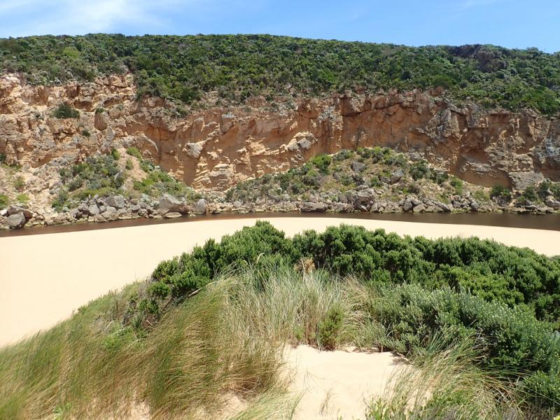
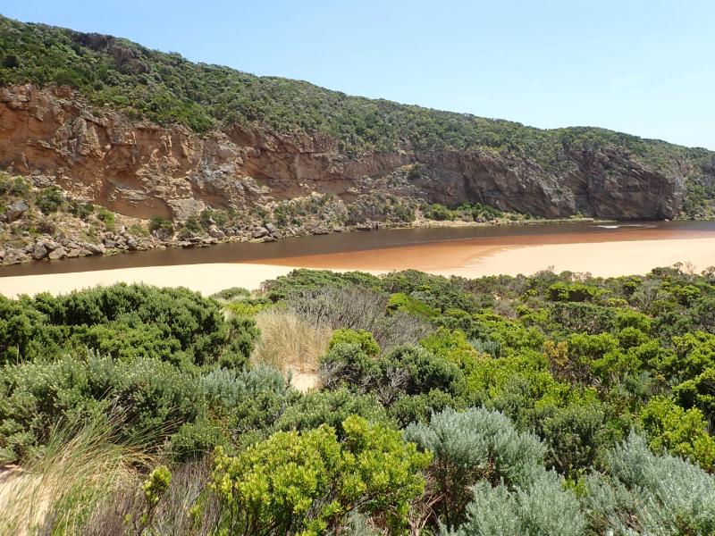
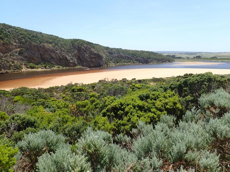
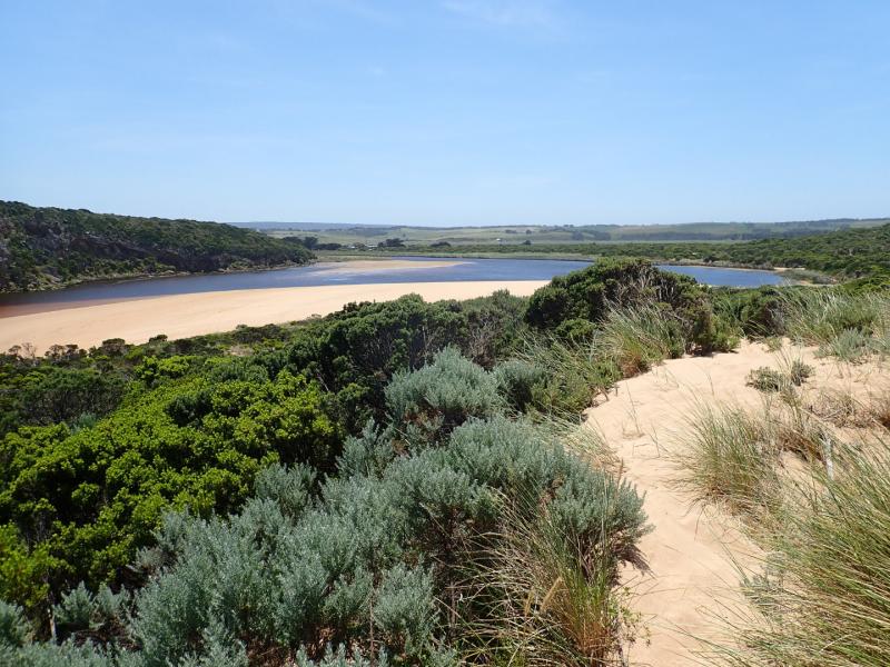
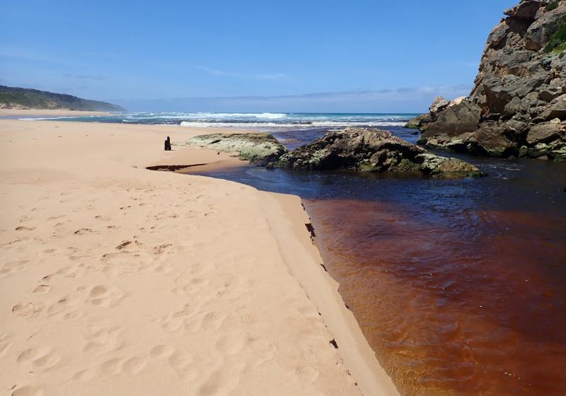
AHD board @ G6 covered with thick silt -Unreadable
Dark discharge flowing out over an increased height of sand buildup around mouth & to south. SW swell impacting on west side of sand projection mid beach creating backwash & longshore drift which is mixing with incoming swell causing small waves up to rocks then low against east side of channel continuing around & across front of large sand projection to SE corner of lagoon. Area east of 1st rock has been filled with sand & water only flowing through narrow gap between !st & 2nd rock with a larger area of flow against cliff.
Very low tide has exposed large areas of sand on ocean beach & in lagoon where areas of algae occur along east side of lagoon. Algae is also covering areas of both west & north wetlands


We honour Elders past and present whose knowledge and wisdom has ensured the continuation of culture and traditional practices.
 All content, files, data and images provided by the EstuaryWatch Data Portal subject to a Creative Commons Attribution License
Data portal by CeRDI
All content, files, data and images provided by the EstuaryWatch Data Portal subject to a Creative Commons Attribution License
Data portal by CeRDI