GMC Gellibrand River Estuary Mouth Observation Site
26 March 2019
Observation details
Overview
| Estuary | Gellibrand River Estuary |
|---|---|
| Site | Gellibrand River Estuary Mouth Observation Site |
| Observation ID | #12826 |
| Date and Time | Tuesday 26th March 2019 09:32am |
| Approved | Approved |
Notes
AHD G2 1.63 @ 09:32 - @11:20 between 1.63 & 1.64. G6 1.63 @ 09:13 Both G2 & G6 are level
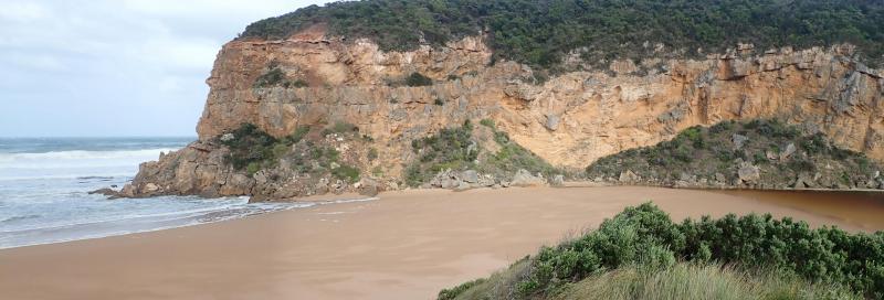
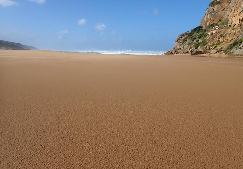
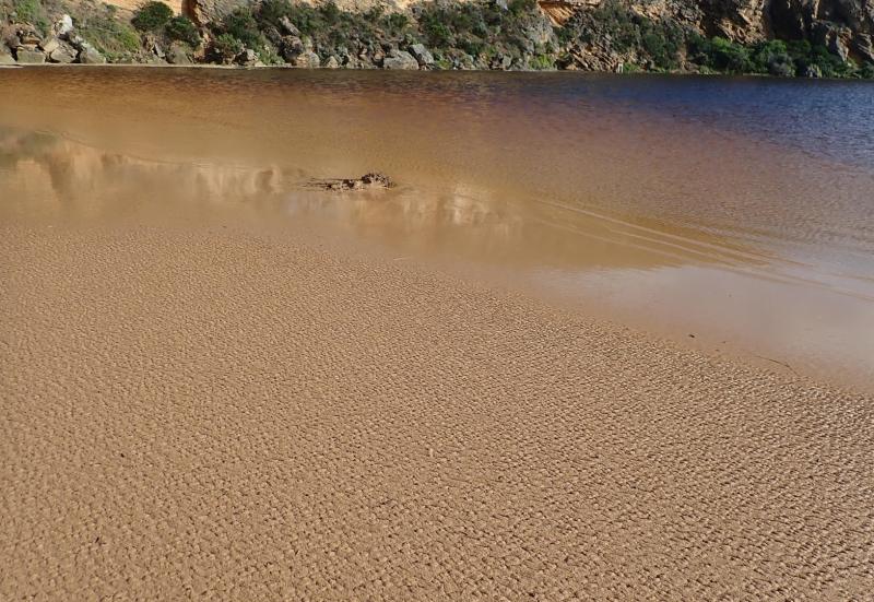
Observations taken @ low tide. Mouth closed but a few waves entering up to estuary -mostly a large expanse of sand between ocean & estuary. SW swell impacting beach - strong backwash @ mid beach carrying large amount of sand then longshore drift to west to cliff. Yesterday's high seas have lowered about 1/3rd of beach east of cliff
Wind in many directions -SE along beach but turning S with much stronger gusts down channel blowing a lot of sand into estuary
Increased water at side of roads & camp ground but water only just coming over OOR at flood markers. Small pool at side of GOR
We acknowledge and respect Victorian Traditional Owners as the original custodians of Victoria’s land and waters, their unique ability to care for Country and deep spiritual connection to it.
We honour Elders past and present whose knowledge and wisdom has ensured the continuation of culture and traditional practices.
We honour Elders past and present whose knowledge and wisdom has ensured the continuation of culture and traditional practices.
 All content, files, data and images provided by the EstuaryWatch Data Portal subject to a Creative Commons Attribution License
Data portal by CeRDI
All content, files, data and images provided by the EstuaryWatch Data Portal subject to a Creative Commons Attribution License
Data portal by CeRDI