Estuary event details
| Estuary | Painkalac Creek Estuary |
|---|---|
| Region | Corangamite CMA |
| Event type | EstuaryWatch Monitoring Group notices & meetings |
| Date and time | 21 July 2022 00:00am |
| Description |
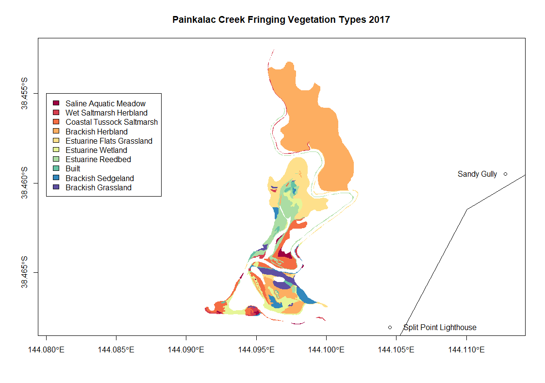
Painkalac Creek fringing vegetation type maps from 2017 These maps have been made by one of EstuaryWatch team Evy Gomm using open source data collected by Sinclair and Kohout 2018 The online data source is: https://discover.data.vic.gov.au/dataset/index-of-estuarine-condition-estuarine-fringing-vegetation The report where the data collection methods are described is attached: Sinclair, S.J. and Kohout, M. (2018). Assessment of fringing vegetation for the index of estuary condition. Arthur Rylah Institute for Environmental Research Technical Report Series No. 290. Department of Environment, Land, Water and Planning, Heidelberg, Victoria.
|

We acknowledge and respect Victorian Traditional Owners as the original custodians of Victoria’s land and waters, their unique ability to care for Country and deep spiritual connection to it.
We honour Elders past and present whose knowledge and wisdom has ensured the continuation of culture and traditional practices.
We honour Elders past and present whose knowledge and wisdom has ensured the continuation of culture and traditional practices.
 All content, files, data and images provided by the EstuaryWatch Data Portal subject to a Creative Commons Attribution License
Data portal by CeRDI
All content, files, data and images provided by the EstuaryWatch Data Portal subject to a Creative Commons Attribution License
Data portal by CeRDI